Wednesday, December 14, 2005
Pakkaskähärää Ylinuortin laaksossa - Freezing mist in the Ylinuortti valley
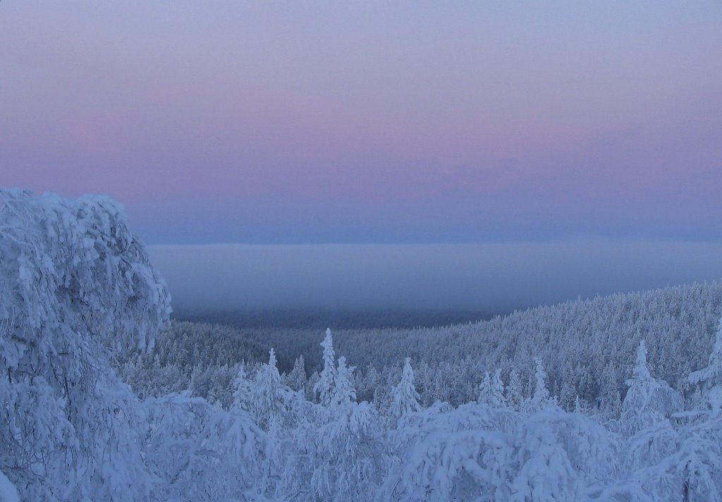 Värriötuntureiden pohjoispuolella, heti Kotovaaran ja Pirunkurun takaa alkaa Ylinuortin laaksomaa, jonka keskellä on itä-länsisuuntainen Nuorttiaapa. Siellä on tutkimusaseman piirtävä lämpötilamittari. Talvisin lämpöolot Ylinuortin laaksomaan ja Värriön lakimaan välillä poikkeavat merkittävästi toisistaan. Kirkkaiden pakkaspäivien yleissääntö on, että Nuorttiaavalla on pakkasta kaksi kertaa se määrä mitä tutkimusaseman mittari näyttää. Kylmä ilma valuu tuntureiden ja vaaran rinteitä alas laaksoon ja Nuorttiaavan ajoittain hyvin kylmäksi. Sääntö rikkoontuu, kun alaspain valuva ilma on niin alijäähtynyttä, että se laaksoon valuessaan tiivistyy pakkassumuksi eli pakkaskähäräksi, joka vaimentaa maan pinnalta ilmakehään lähtevää pitkäaaltoista lämpösäteilyä. Ilmiö tapahtui muun muassa pakkaspäivänä 14.12.2005. Kuvanottohetkellä (klo 11) pakkasta oli Värriö ykkösen pohjoisrinteessä noin -15 astetta. Pakkaskähärä peitti koko Ylinuortin laakson, heti Kotovaaran (oikealla) ja Pirunkurun (keskellä) takaa.
A large valley on both sides of Ylinuortti river, starts just North of the Varrio fells, below Kotovaara hill (to the right in the photo) and Devil's creek (in the middle). A large Nuorttiaapa mire runs east to west in the valley. Temperature is constantly recorded in a mechanical thermograph down at the western (lower) end of Nuorttiaapa.
The winterly temperature conditions between Nuorttiaapa and Kotovaara measurement points differ in a peculiar manner. The main rule for clear, cold days usually holds: the freezing temperatures down in the valley are twice as low as they up in the hill. This may be explained (described) by the heavier cold air which in still weather moves by gravity from the hills down to the valley. The downhill skiiers know the temperature differences in their face. This temperature phenomenon is disturbed when the cold air is simultaneously so supercool that it condenses into freezing mist. The mist in the valley prevents the emission of the long-wave outgoing radiation and the air temperature does not drop that fast. This kind of weather prevailed on 14 December. The temperature on the northern slope of Varrio I, at photographing time (11 o´clock) was about -15 degrees. The freezing mist starts right below Devil's creek and Kotovaara hill.
// posted by Veli Pohjonen @ 18:21 
![]()