Wednesday, November 16, 2005
Rakitsa ja Pulkkatunturi marrashuurteessa - Rakitsa hill and Pulkkatunturi fell in frozen dew
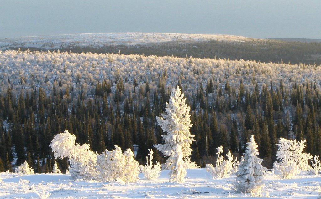 Marraskuun ensilumi tulee usein vahvana huurteena vaarojen ja tunturien lakipuihin. Se johtuu lounaisista kosteista tuulista, jotka tulevat Pohjanlahden ja Perämeren suunnasta, alijäähtyvät noustessaan ilmakehässä ylöspäin. Huurre ja myöhemmin tykky syntyvät ensin korkeille maille, kuten Värriötuntureiden vedenjakajaselänteelle. Kuva Värriö I:n itärinteeltä, yli Rakitsan vaaran, kohti Pulkkatunturia.
The first snow in November comes oftern as thick frozen dew on tops of hills and fells. The phenomenon results from moist south-western winds that blow over open Gulf of Bothnia. The moist winds form supercool clouds when they rise higher in the nearer atmosphere. Frozen dew and later heavy frozen dew (Finnish: tykky) appear first in higher altitude areas, like the Varrio divide. The photo is taken from Varrio I fell towards east, over Rakitsa hill to Pulkkatunturi fell.
// posted by Veli Pohjonen @ 20:51 
![]()